 Tweet
Tweet
Northern Rivers 4x4 Trail
Let me summarise simply... Wow, what a trip!
We took 5-days, camping along the way. Things that were great about this trip...
- Many campsite options gave us plenty of touring flexibility
- Riverside camping is free!
- Big and fast flowing rivers
- Beauty and grandeur
- Plenty of side-tracks to explore
- Avoids most black-top
- No mobile phone coverage (3G, Telstra, Optus, Vodaphone).
- Being with like-minded family/friends
The Northern Rivers 4x4 Trail introduces you to the Clarence River, Mann River, Boyd River, Nymboida River.
I preloaded my GPS (Garmin Nuvi 760) with all the planned routes and several alternatives. Also loaded with ShonkyMaps, Shonky Contours and Tracks4Australia, there was no excuse for getting lost . The Garmin turned out to be an invaluable tool for exploring otherwise unmkared trails.
Day 1 - Beaudesert to Iron Pot Creek, (via Old Mt Lindesay Hwy and Tooloom Falls)
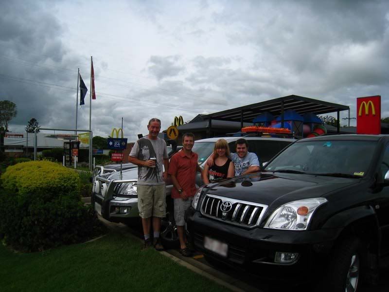
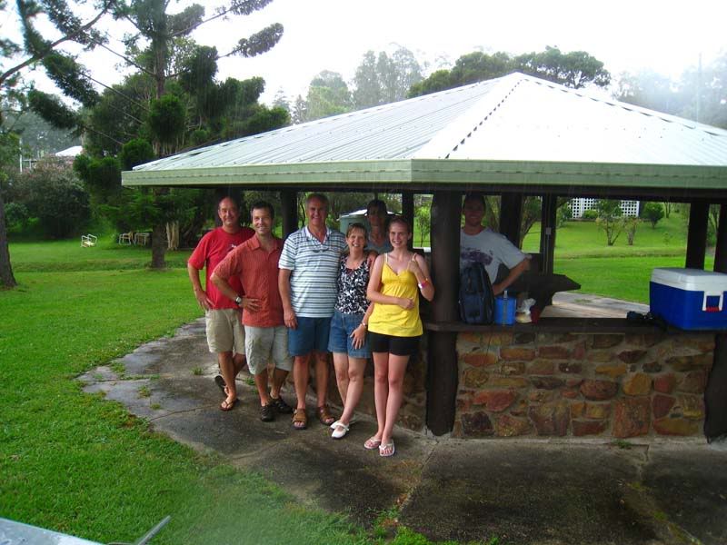
The journey began when we met at McDonald's in Beaudesert.
Soon we were headed south on the Mt. Lindesay Hwy and eagerly looking for side-tracks to explore. It wasn't long before we turned-off on The Old Mount Lindesay Hwy. Both my GPS and Google Maps show this road crossing the QLD/NSW boarder and connecting Mt Lindesay Hwy with the Summerland Way. Perfect! Unfortunately, the mapping software did not highlight a double-gate padlocked to the hilt. We could drive as far as the border, but there was no way through.
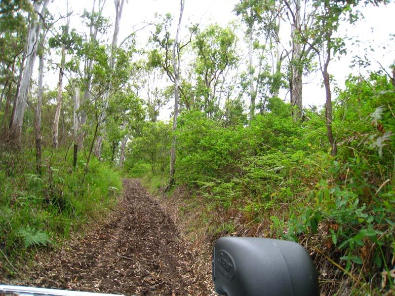
All the same, the Old Mount Lindesay Hwy proved to be an outstanding detour. It's an unsealed road that passes through farmland and several gates. It provided some relatively easy 4WD'ing mixed with magnificent country-side, views to Mount Lindesay, and it was greener than I've ever seen it.
Here is one of the soft-trails on Old Mount Lindesay Hwy:
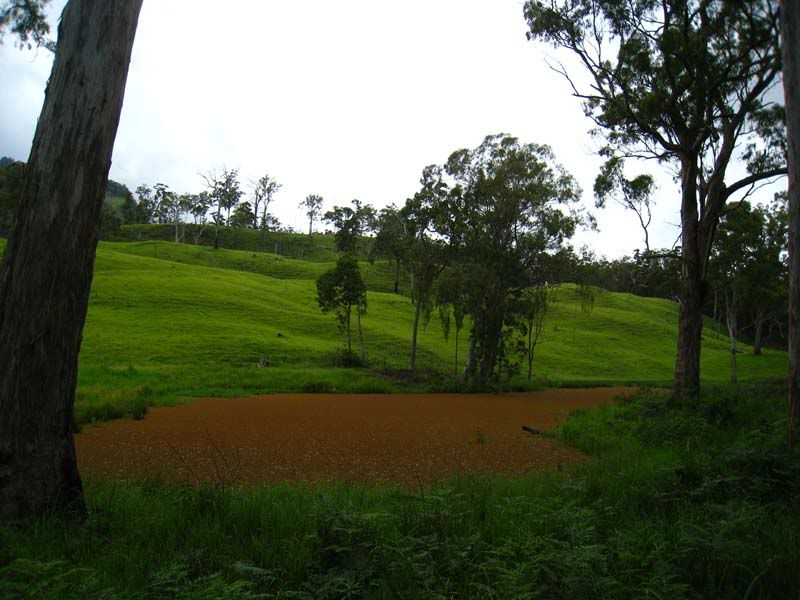
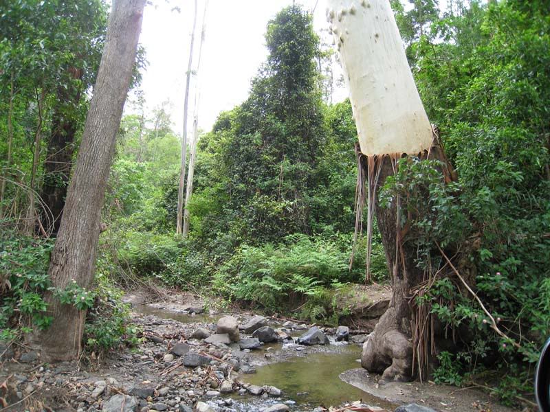
A fern-covered pond provided artistic contrast to the green landscape:
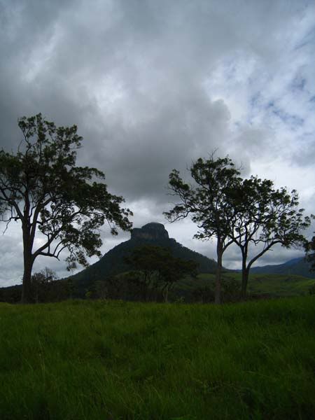
We saw Mount Lindesay from every direction. Mount Lindesay reveals its characteristic tiers:
A few easy creek crossings and plenty of cows for entertainment:
When we arrived at what I believe was the border, we were faced with these double-gates, both padlocked. That's me in no-man's land.
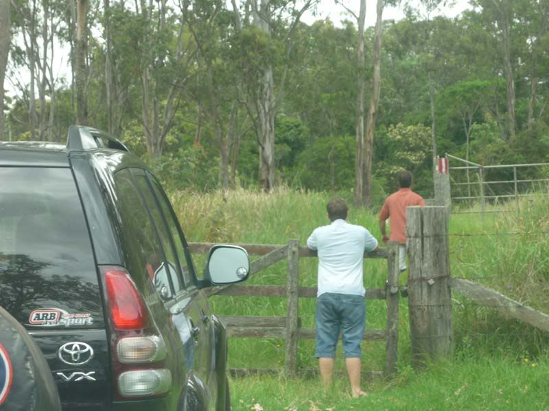
We had no other choice but return to the Mt. Lindesay Hwy to continue on our way.
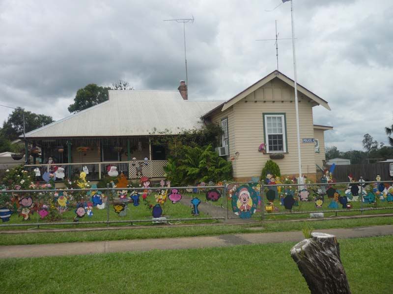
The northern head of The 4x4 Trail is at the curiously named town of Woodenbong - the local police station was entertaining in its own right and in keeping with the name of the town...
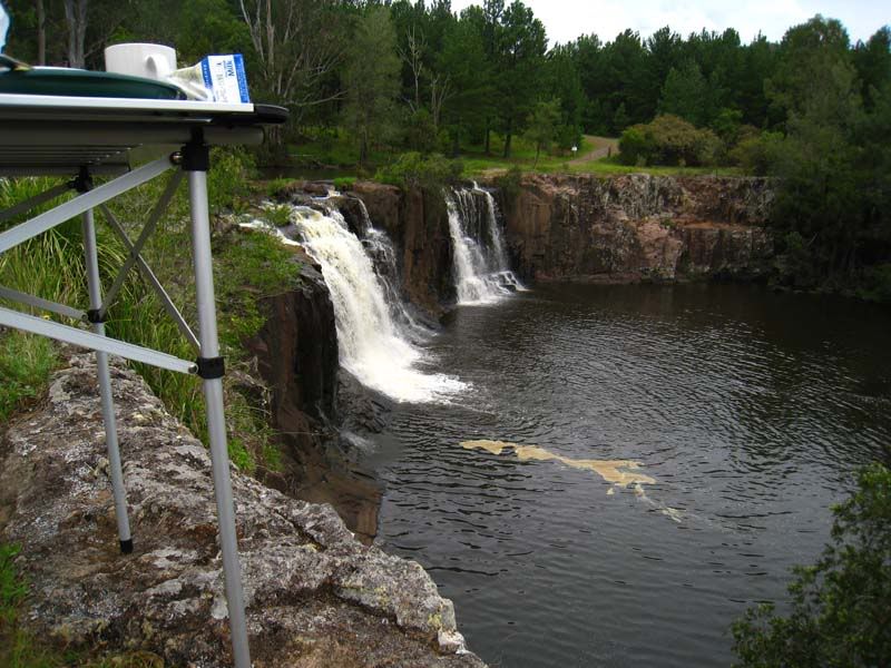
A little south-west of Woodenbong and just south of Urbenville, is Tooloom Falls. This was our lunch stop:
Tooloom Falls eventually feeds into the Clarence River. It provides basic camping and it is very popular for quads and motorcycles. In our case, we crossed over the causeway and continued through some bush-trails. Eventually, we wound our way North-East, through farmland, back to Summerland Way in search of Cox's Road, which takes us into Toonumbar National Park.
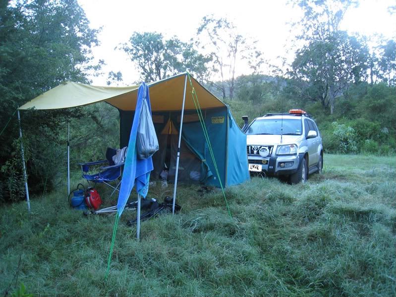
Our first night was spent at Iron Pot Creek Campground. It offers basic facilities (long-drop loo) with each campsite in a private setting surrounded by rainforest.

Day 2 - Iron Pot Creek to Yates Crossing
If only we knew what lay ahead on this day... The day started out with a pleasant drive to the Toonumbar Dam, where we took the time for some exploring by foot:
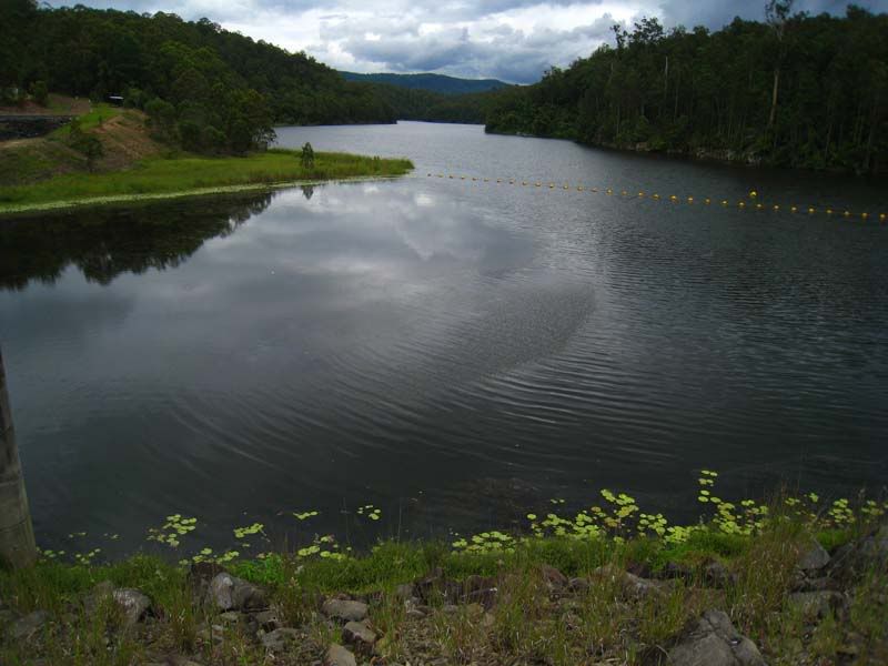
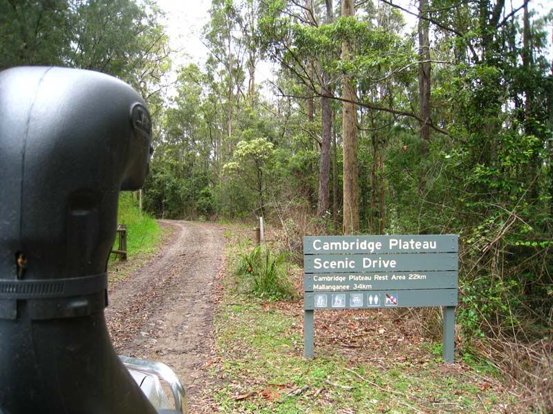
The remainder of the drive was intended to follow the Cambridge Plateau, which runs north-south along the Richmond Range, all the way to Mallanganee on the Bruxner Hwy.
In the spirit of this little exploration, I noticed a promising track named Paw Paw Skids. This is where the GPS left me a little misguided, giving me the false promise of tracks that would return us to the Cambridge Plateau. Instead, we found ourselves literally axing our way through fallen timber and breaking back lantana that more than just threatened to pin-stripe our paintwork.
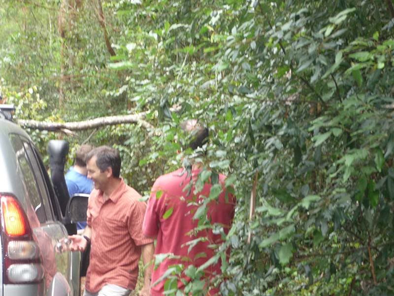
This part of the adventure had us discovering poorly maintained fire trails and we worked hard to cut our way through the occassional thorn-covered blockage. All the same, the bush-trail was fun and at times quite exciting. The sense of nobody having been on this trail for such a long time only added to the mystique of where it was to lead us. Meanwhile, the GPS maps showed the trail depositing us just south of a small town called Bonalbo.
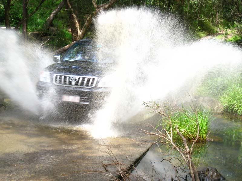
We also managed to wash away some of the mud and dirt...
In retropsect, we over-spent our time on this trail. It was a little disappointing to not see the remainder of the Cambridge Plateau, so that will be something to savour on a future trip.
All the same, this did afford us a chance encounter with fellow PradoPointers. As we approached Mallanganee, the heavens had ripped apart and unleashed bucket-sized drops of water across the land. When we entered the town, who should we find huddled under a picnic rotunda, but our fellow PP'ers. (Hi to Jim, Allan and their families!).
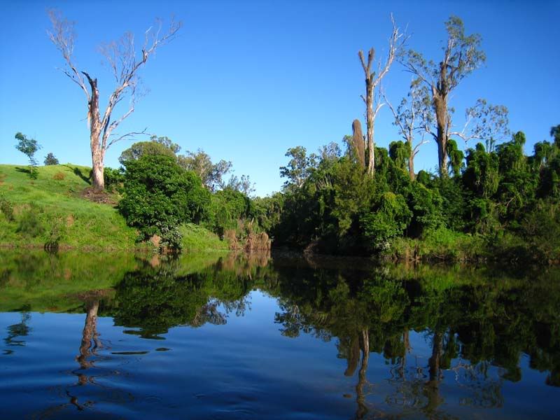
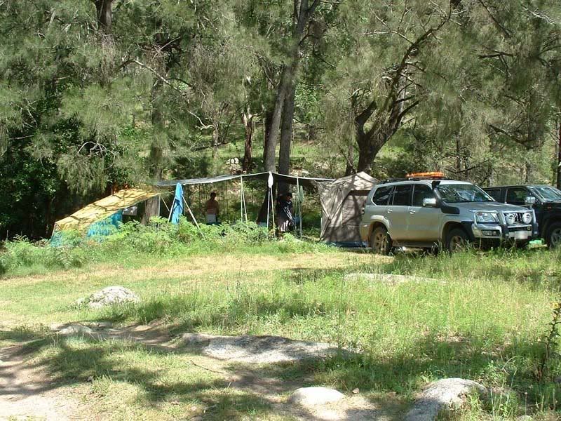
The looming evening was pressing us to review our earlier plan. A decision was made to head to Yates Crossing to setup camp. Naturally, we would not take the black-top, and continued our path through more unsealed road and farm country. As it turned out, Yates Crossing was a delighter. Nestled along a spectacular part of the Clarence River, with some sections of rapids to keep us entertained. Too many pics to show, so here is a couple of my choices: (Note that there are no facilities at Yates Crossing).
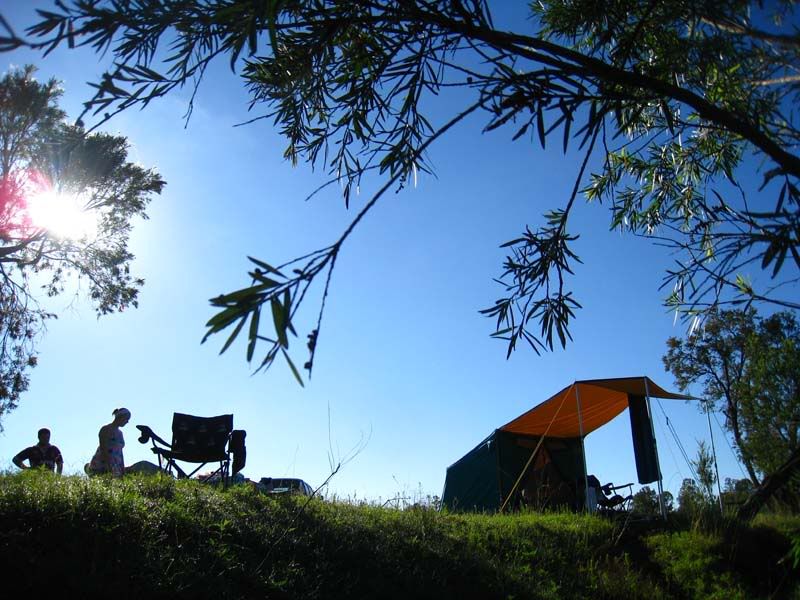
There is a huge area available for campers. We setup on the cliff edge, with a walkway down to the bubbling river.
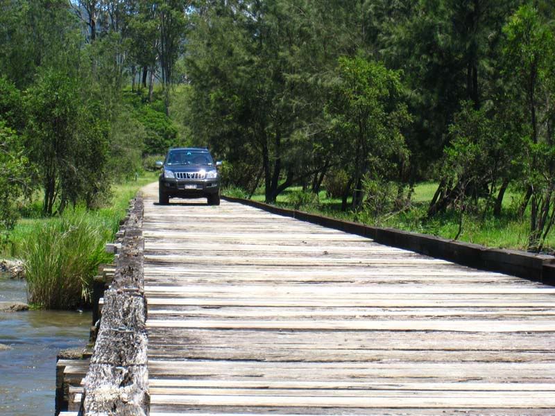
Day 3 - Yates Crossing to Mann River Nature Reserve, via Jackadgery
This was a longish day of driving. There is an interesting wooden bridge crossing the Clarence River:
Stunning views along the Gwydir Hwy around the Gibraltar Ranges and Washpool National Park.
We expected Jackadgery to be a little township, but in fact it is no more than a caravan park on the Gwydir Hwy. They did sell fuel and food.
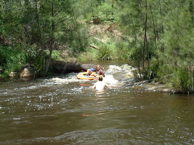
The camground at Mann River Nature Reserve is on the Old Glen Innes - Grafton Hwy. It was comfortable and once again, the riverside camping was outstanding.
The river has a couple of small sections of rapids, suitable for inflatable boats for the kids.
Day 4 - Mann River to Nymboida River Camp
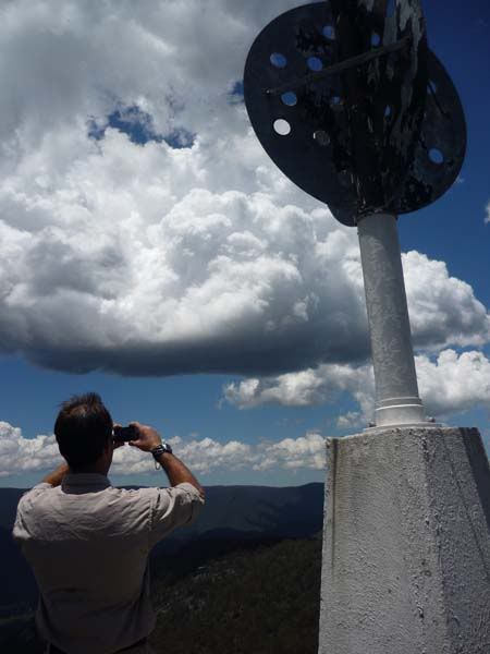
The Old Glen Innes - Grafton Hwy provided some of the most picturesque views of the trip. The first bit of fun was found around 10km after leaving the camground. We took the turn-off to Tom's Lookout, via the Narrow Pass Fire Trail, which provided some entertaining 4WD'ing and when we arrived at the lookout, the views were breathtaking.
It follows the Boyd river, which has many spectacular sections. Once again, there are many options for camping along this river. So if you wanted to take more time enjoying this part of the world, it would be very easy.
Eventually, we came to a tunnel that was hand-carved through solid stone by the convicts in the late 1800's. This is the only rock outcrop along the way and is just 6kms west of Dalmorton. One of the campers I met mentioned their Winnebago would fit under it, but because of the roundness of the tunnel, the corners of their campervan would have been reformed if they pressed on. There is no other way around, so they had to return.
This was quite cool, and we couldn't resist a few fun shots...
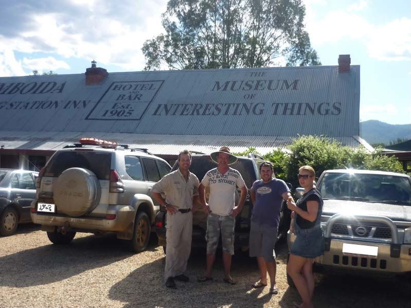
We travelled into Nymoboida, expecting to find food and fuel. Unfortunately, no fuel and the only place we found food was at this odd place:
From here we backtracked to the Nymboida River Camp ground. It is odd that there are very few signs indicating how to get there. We followed the GPS and my nose to discover this area. Again, we camped right beside the river.
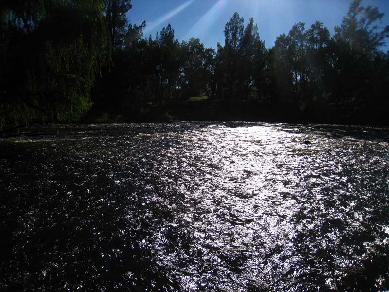
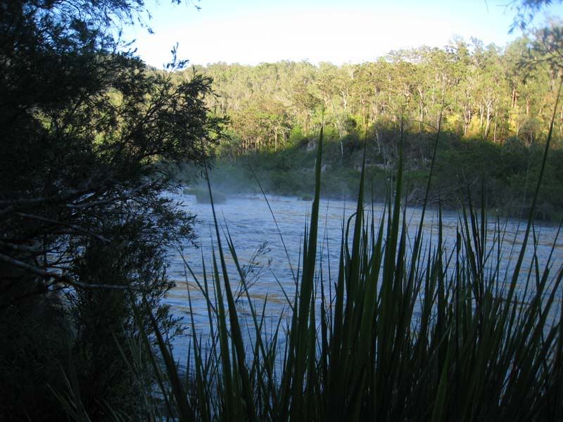
This is one seriously fast-flowing river. I wanna come back with a kayak to explore this area quite a bit more. This next photo just doesn't do it justice, but I tried...
Day 5 - Nymboida River Camp to Home
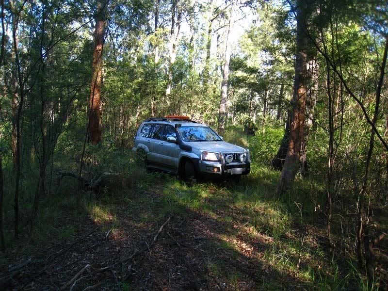
Not far from the campground, we found a fun and very very steep trail. It lead nowhwere:
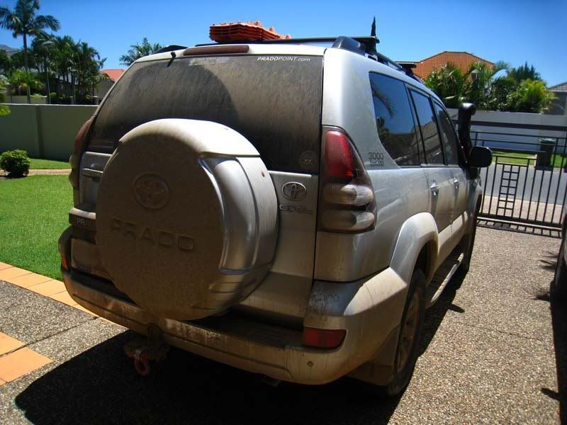
Back home, the car was looking like it had done what it was bought for . Many many looks by passers by. The hand car-wash guys were quite amused.
LFaR.
Let me summarise simply... Wow, what a trip!
We took 5-days, camping along the way. Things that were great about this trip...
- Many campsite options gave us plenty of touring flexibility
- Riverside camping is free!
- Big and fast flowing rivers
- Beauty and grandeur
- Plenty of side-tracks to explore
- Avoids most black-top
- No mobile phone coverage (3G, Telstra, Optus, Vodaphone).
- Being with like-minded family/friends
The Northern Rivers 4x4 Trail introduces you to the Clarence River, Mann River, Boyd River, Nymboida River.
I preloaded my GPS (Garmin Nuvi 760) with all the planned routes and several alternatives. Also loaded with ShonkyMaps, Shonky Contours and Tracks4Australia, there was no excuse for getting lost
Day 1 - Beaudesert to Iron Pot Creek, (via Old Mt Lindesay Hwy and Tooloom Falls)
The journey began when we met at McDonald's in Beaudesert.
Soon we were headed south on the Mt. Lindesay Hwy and eagerly looking for side-tracks to explore. It wasn't long before we turned-off on The Old Mount Lindesay Hwy. Both my GPS and Google Maps show this road crossing the QLD/NSW boarder and connecting Mt Lindesay Hwy with the Summerland Way. Perfect! Unfortunately, the mapping software did not highlight a double-gate padlocked to the hilt. We could drive as far as the border, but there was no way through.
All the same, the Old Mount Lindesay Hwy proved to be an outstanding detour. It's an unsealed road that passes through farmland and several gates. It provided some relatively easy 4WD'ing mixed with magnificent country-side, views to Mount Lindesay, and it was greener than I've ever seen it.
Here is one of the soft-trails on Old Mount Lindesay Hwy:
A fern-covered pond provided artistic contrast to the green landscape:
We saw Mount Lindesay from every direction. Mount Lindesay reveals its characteristic tiers:
A few easy creek crossings and plenty of cows for entertainment:
When we arrived at what I believe was the border, we were faced with these double-gates, both padlocked. That's me in no-man's land.
We had no other choice but return to the Mt. Lindesay Hwy to continue on our way.
The northern head of The 4x4 Trail is at the curiously named town of Woodenbong - the local police station was entertaining in its own right and in keeping with the name of the town...
A little south-west of Woodenbong and just south of Urbenville, is Tooloom Falls. This was our lunch stop:
Tooloom Falls eventually feeds into the Clarence River. It provides basic camping and it is very popular for quads and motorcycles. In our case, we crossed over the causeway and continued through some bush-trails. Eventually, we wound our way North-East, through farmland, back to Summerland Way in search of Cox's Road, which takes us into Toonumbar National Park.
Our first night was spent at Iron Pot Creek Campground. It offers basic facilities (long-drop loo) with each campsite in a private setting surrounded by rainforest.
Day 2 - Iron Pot Creek to Yates Crossing
If only we knew what lay ahead on this day... The day started out with a pleasant drive to the Toonumbar Dam, where we took the time for some exploring by foot:
The remainder of the drive was intended to follow the Cambridge Plateau, which runs north-south along the Richmond Range, all the way to Mallanganee on the Bruxner Hwy.
In the spirit of this little exploration, I noticed a promising track named Paw Paw Skids. This is where the GPS left me a little misguided, giving me the false promise of tracks that would return us to the Cambridge Plateau. Instead, we found ourselves literally axing our way through fallen timber and breaking back lantana that more than just threatened to pin-stripe our paintwork.
This part of the adventure had us discovering poorly maintained fire trails and we worked hard to cut our way through the occassional thorn-covered blockage. All the same, the bush-trail was fun and at times quite exciting. The sense of nobody having been on this trail for such a long time only added to the mystique of where it was to lead us. Meanwhile, the GPS maps showed the trail depositing us just south of a small town called Bonalbo.
We also managed to wash away some of the mud and dirt...
In retropsect, we over-spent our time on this trail. It was a little disappointing to not see the remainder of the Cambridge Plateau, so that will be something to savour on a future trip.
All the same, this did afford us a chance encounter with fellow PradoPointers. As we approached Mallanganee, the heavens had ripped apart and unleashed bucket-sized drops of water across the land. When we entered the town, who should we find huddled under a picnic rotunda, but our fellow PP'ers. (Hi to Jim, Allan and their families!).
The looming evening was pressing us to review our earlier plan. A decision was made to head to Yates Crossing to setup camp. Naturally, we would not take the black-top, and continued our path through more unsealed road and farm country. As it turned out, Yates Crossing was a delighter. Nestled along a spectacular part of the Clarence River, with some sections of rapids to keep us entertained. Too many pics to show, so here is a couple of my choices: (Note that there are no facilities at Yates Crossing).
There is a huge area available for campers. We setup on the cliff edge, with a walkway down to the bubbling river.
Day 3 - Yates Crossing to Mann River Nature Reserve, via Jackadgery
This was a longish day of driving. There is an interesting wooden bridge crossing the Clarence River:
Stunning views along the Gwydir Hwy around the Gibraltar Ranges and Washpool National Park.
We expected Jackadgery to be a little township, but in fact it is no more than a caravan park on the Gwydir Hwy. They did sell fuel and food.
The camground at Mann River Nature Reserve is on the Old Glen Innes - Grafton Hwy. It was comfortable and once again, the riverside camping was outstanding.
The river has a couple of small sections of rapids, suitable for inflatable boats for the kids.
Day 4 - Mann River to Nymboida River Camp
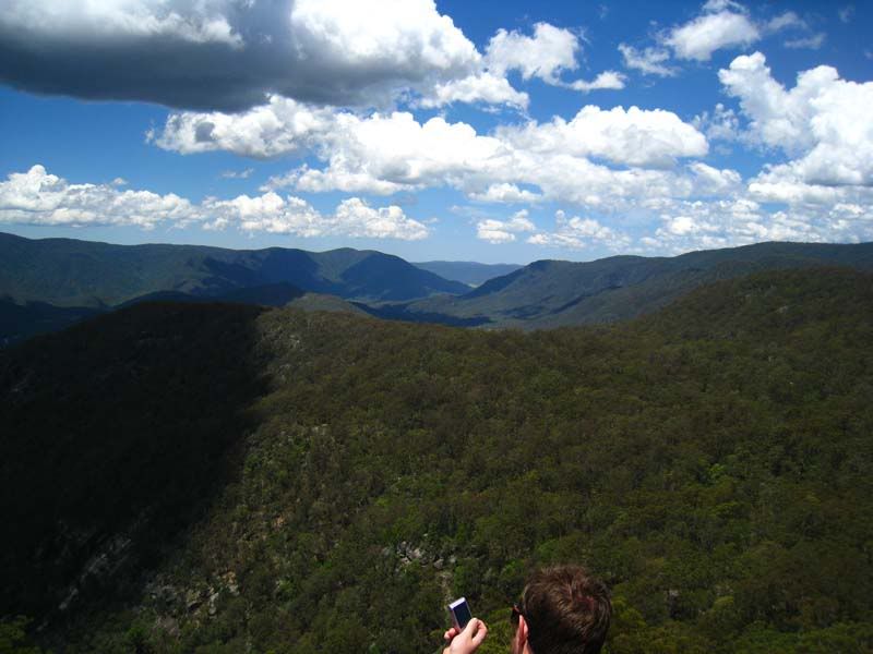
The Old Glen Innes - Grafton Hwy provided some of the most picturesque views of the trip. The first bit of fun was found around 10km after leaving the camground. We took the turn-off to Tom's Lookout, via the Narrow Pass Fire Trail, which provided some entertaining 4WD'ing and when we arrived at the lookout, the views were breathtaking.
It follows the Boyd river, which has many spectacular sections. Once again, there are many options for camping along this river. So if you wanted to take more time enjoying this part of the world, it would be very easy.
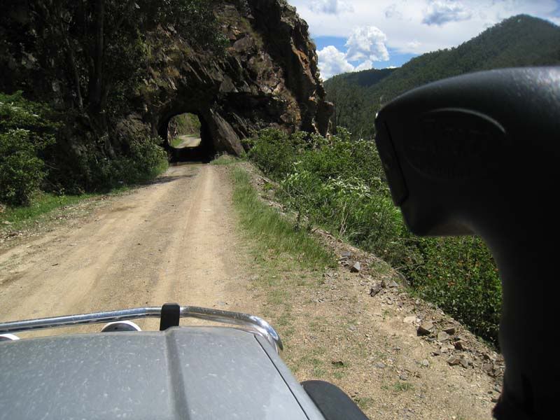
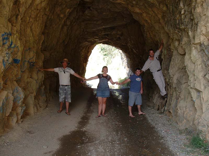
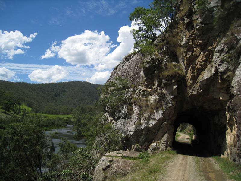
Eventually, we came to a tunnel that was hand-carved through solid stone by the convicts in the late 1800's. This is the only rock outcrop along the way and is just 6kms west of Dalmorton. One of the campers I met mentioned their Winnebago would fit under it, but because of the roundness of the tunnel, the corners of their campervan would have been reformed if they pressed on. There is no other way around, so they had to return.
This was quite cool, and we couldn't resist a few fun shots...
We travelled into Nymoboida, expecting to find food and fuel. Unfortunately, no fuel and the only place we found food was at this odd place:
From here we backtracked to the Nymboida River Camp ground. It is odd that there are very few signs indicating how to get there. We followed the GPS and my nose to discover this area. Again, we camped right beside the river.
This is one seriously fast-flowing river. I wanna come back with a kayak to explore this area quite a bit more. This next photo just doesn't do it justice, but I tried...
Day 5 - Nymboida River Camp to Home
Not far from the campground, we found a fun and very very steep trail. It lead nowhwere:
Back home, the car was looking like it had done what it was bought for
LFaR.


 Snaga
Snaga
Comment